Six Mile Cypress Slough
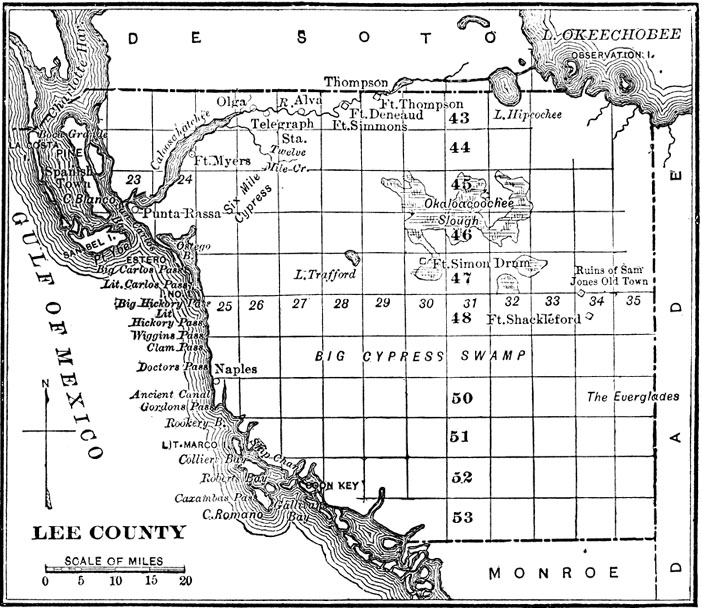 After leaving Fort Myers, the Expedition party traveled southeast and stopped to eat at "7 mile cypress," according to the official record by W.R. Moses. This is probably an error and a reference to the Six Mile Cypress Slough. Some sources indicate that it was called Six Mile Cypress because cattlemen and other travelers knew that when they reached the slough they only had another six miles before they arrived at Fort Myers. In MacCauley's Seminole Indians of Florida he describes a region that might be the slough: "Six miles from Myers we crossed a cypress swamp, in which the water at its greatest depth was from one foot to two feet deep. A wagon road had been cut through the dense growth of trees, and the trees were covered with hanging mosses and air plants." The present-day Six Mile Cypress Slough Preserve, which was created in 1970, is over 3,400 acres of wetlands in Fort Myers.
Credits:
Sources:
References in the Texts:
Links below open in a new browser window.
For other topics referenced in the Expedition texts, please refer to the Index to Subjects and Names.
1892 Everglades Exploration Expedition : Three Digital Texts, 2015