Map of the Expedition
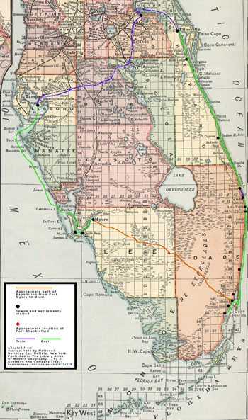 The current phase in this project is to provide geographical context: using course headings, landmarks, and other evidence found in the texts to map the route that the Expedition party took from Fort Myers to Miami through the Everglades, as well as other locations along the west and east coasts of Florida. The goal of this project phase is to create an interactive map showing the routes traveled by the Expedition party on foot, boats and trains; the camp sites between Fort Myers and Miami; and the towns, settlements and other landmarks they visited. In addition to geolocating these sites and routes based on information from the Expedition texts, the interactive map will include temporal information to show their progress chronologically.
During development of this interactive contextual map, a static map is provided that shows the approximate route traveled from Fort Myers to Miami and the towns and settlements visited. The map is available in two sizes:
This map is adapted from the map of Florida, 1891, by Matthews-Northrup Co., Buffalo, New York, published in The Library Atlas of Modern Geography... by D. Appleton and Co. (1892) (source: David Rumsey Map Collection).
1892 Everglades Exploration Expedition : Three Digital Texts, 2015