About the Project
 In 1892 James E. Ingraham, President of the South Florida Railroad, organized an expedition that traveled across the Everglades from Fort Myers on Florida's west coast to Miami on the east coast. The Expedition was supported by railroad and hotel magnate Henry B. Plant, and was referred to in various accounts as the "Everglade Exploring Expedition" or the "Ingraham Everglades Expedition." Expedition members included Sydney O. Chase, owner of Chase and Company, a leading citrus business in the state, and several men who worked for the South Florida Railroad. It was widely reported that the purpose for the Expedition was to survey a route for a railway line across the Everglades. The true purpose of the Expedition, however, was to investigate the Everglades to determine if the land could be drained for agriculture and development. This was not an original idea; people had proposed drainage and "land reclamation" for years, and Hamilton Disston had already invested a considerable amount of money in an attempt to drain the water.
Texts
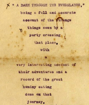
Three men kept records and diaries of this significant Expedition: Wallace R. Moses served as official secretary for the Expedition and authored the official record, James E. Ingraham kept his own diary, and compassman Alonzo Church kept a diary which he later published under the title, A Dash Through the Everglades. It is unknown if their original diaries and notes exist, but typescripts of these texts are available in the James E. Ingraham Papers and the Chase Collection in the Special and Area Studies Collections Department of the University of Florida George A. Smathers Libraries. Digital reproductions of the typescripts are available at:
- Moses, W.R., Record of the Everglade Exploration Expedition
- Ingraham, J.E., Diary
- Church, A., A Dash Through the Everglades
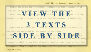 The three encoded texts are presented side-by-side chronologically. Some of the texts also have front matter and back matter, such as cover letters or notes on end pages. The three texts have been transcribed and are represented in Text Encoding Initiative (TEI) P5 XML encoding. Line and page breaks have not been preserved in the encoded manuscripts. Any information supplied by the editor during encoding is enclosed in square brackets. For example, a date supplied by the editor might appear as: [March 16, 1892].
Map
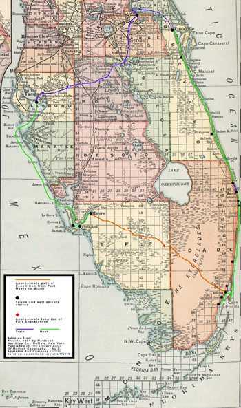 The current phase in this project is to provide geographical context: using course headings, landmarks, and other evidence found in the texts to map the route that the Expedition party took from Fort Myers to Miami through the Everglades, as well as other locations along the west and east coasts of Florida. The goal of this project phase is to create an interactive map showing the routes traveled by the Expedition party on foot, boats and trains; the camp sites between Fort Myers and Miami; and the towns, settlements and other landmarks they visited. In addition to geolocating these sites and routes based on information from the Expedition texts, the interactive map will include temporal information to show their progress chronologically.
During development of this interactive contextual map, a static map is provided that shows the approximate route traveled from Fort Myers to Miami and the towns and settlements visited. The map is available in two sizes:
This map is adapted from the map of Florida, 1891, by Matthews-Northrup Co., Buffalo, New York, published in The Library Atlas of Modern Geography... by D. Appleton and Co. (1892) (source: David Rumsey Map Collection).
Title Image : American Museum of Natural History Digital Special Collections, Julian Dimock Collection, Image Number 49308: "Boat landing, The Everglades, Florida, 1910."